Spatial Intelligence

Turn Spatial Data Into Better Decisions

Spatial intelligence for real estate, construction and infrastructure.

SPATIAL DECISION WORKSPACELive analysis
Which sites are ready for development?
Analyzing spatial contextLive analysis
Decision signal78 / 100

favourable context

Reasons

Strong access

Growing activity

Low constraint

Evidence

Access, surrounding activity and site constraints

From maps to decisions

Maps show you where. Spatial intelligence tells you what it means.

We do not build maps for the sake of maps. We build systems that turn spatial information into actionable intelligence.

01

Traditional GIS

Spatial Data
MapStatic map + data layers
Human InterpretationPeople interpret what they see
Decision
02

Spatial Intelligence

Decision support
Spatial Data
AI + Spatial Analysis
Patterns / Risks / OpportunitiesDetected signals and context
EvidenceEvidence-backed next step
Decision

Product evidence

See Spatial Intelligence in Action.

Real products. Real spatial data. Built to turn complex information into actionable evidence.

Product

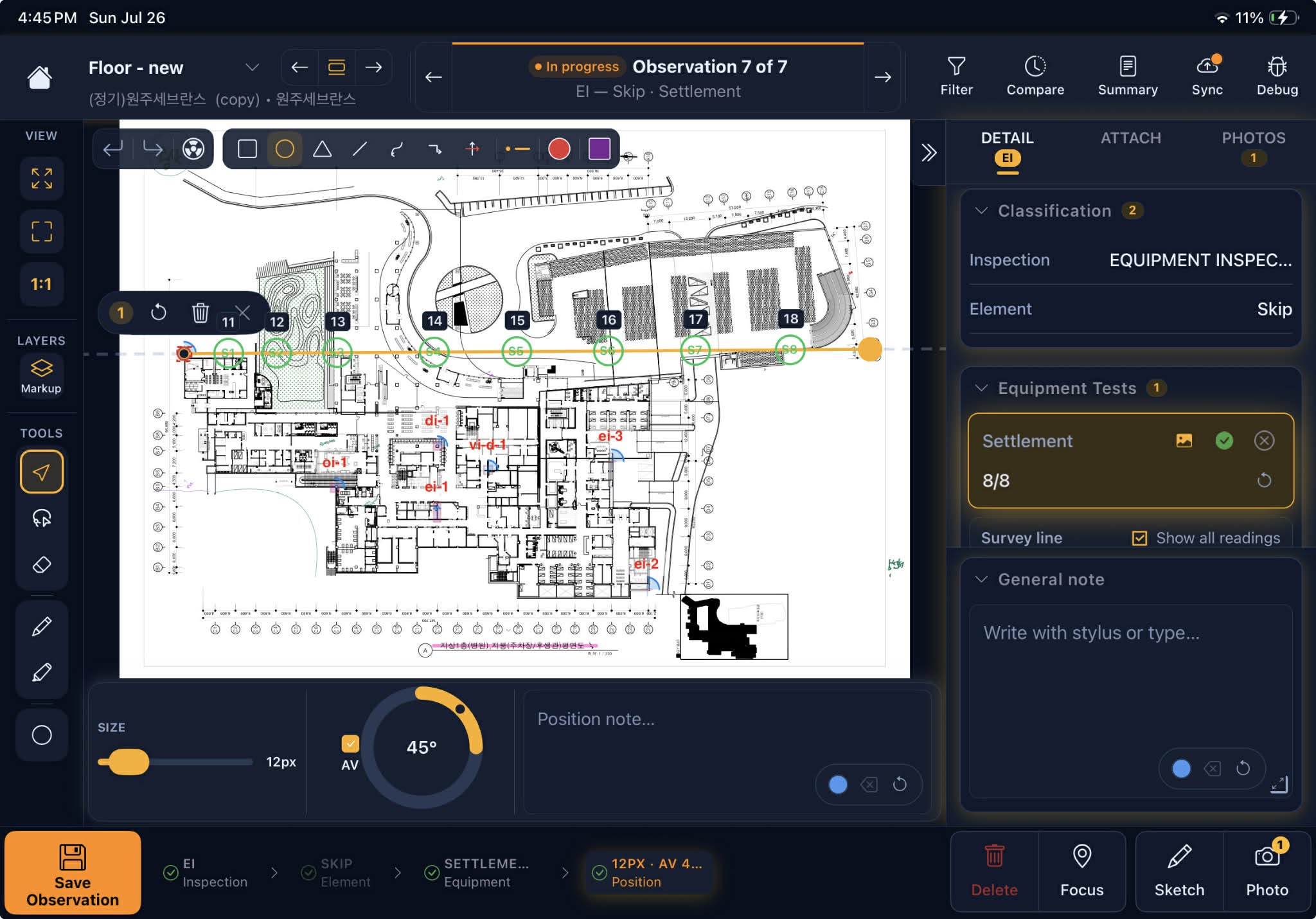
iPad Field Survey App

ProblemSurvey teams rely on paper records, causing errors and lost field data, and requiring repeated site visits to reconcile.
SolutionAn iPad survey app captures coordinates, photos and notes on-site, syncs data instantly and exports standardized reports.
OutcomeShortens field survey time and reduces manual data-entry errors.

Product

MetaMap Platform

ProblemBusinesses need an online mapping tool to visualize and analyze spatial data, but foreign solutions are costly and hard to customize.
SolutionMetaMap is a browser-based map-building and spatial analysis platform for building, sharing and analyzing interactive maps.
OutcomeLaunch a mapping project in hours instead of weeks.

What can we help you decide?

Turn spatial data into clear, precise action

For real estate, construction and infrastructure.

01

Real Estate Intelligence

A multi-layer analysis platform to value assets, optimize planning and reduce investment risk.

  • Site Feasibility Analysis: Automate site potential assessment using transport, nearby amenities and population density data.
  • Zoning & Legal Constraint Mapping: Contextualize 2D/3D planning layers and automatically flag legal risks and architectural limits.
  • Development Scenario Modeling: Identify the best-use land development scenarios to maximize ROI.
Explore Real Estate Intelligence
02

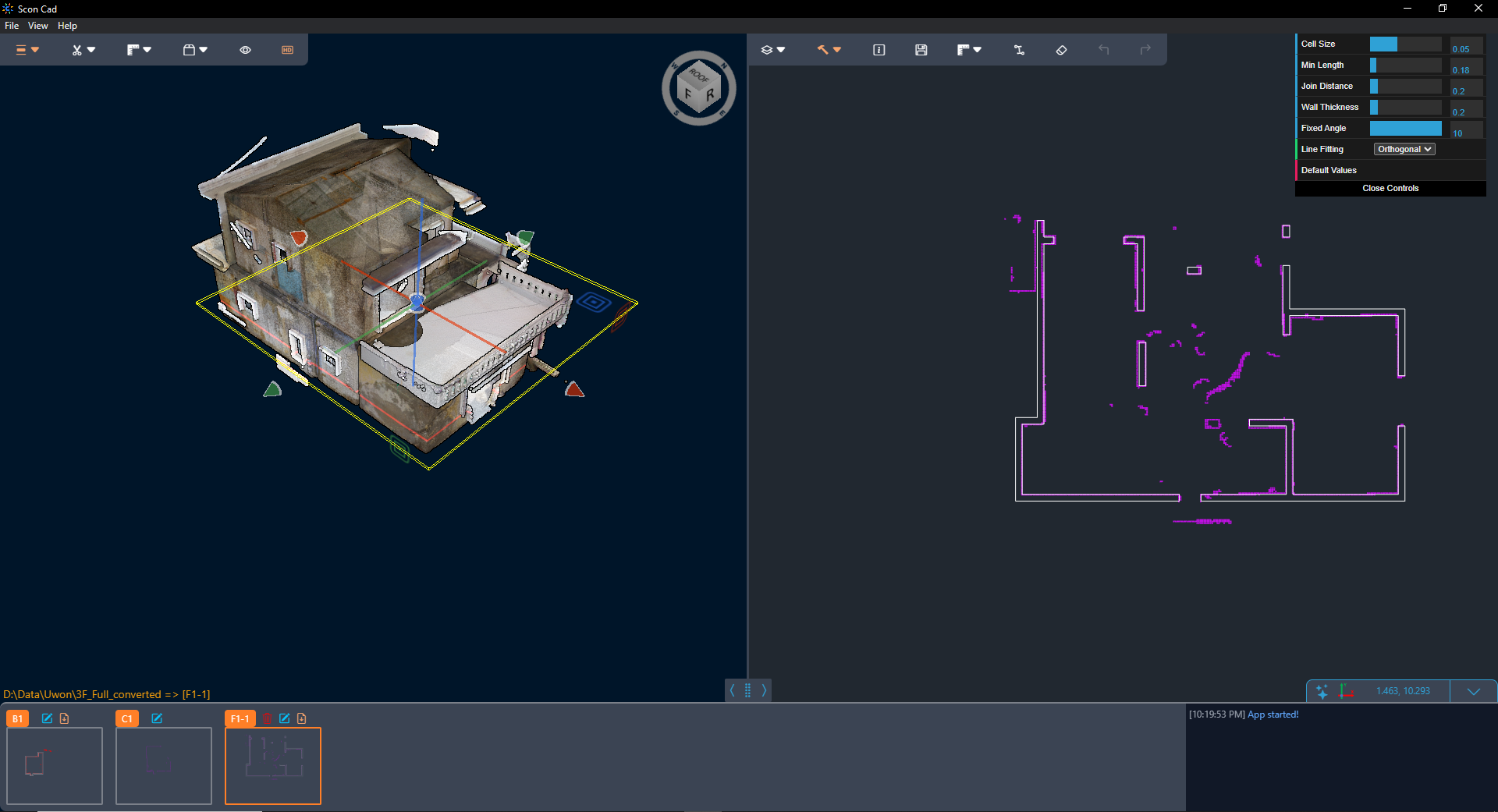
Construction & 3D Intelligence

Digitize the construction site and automate real-time construction quality control.

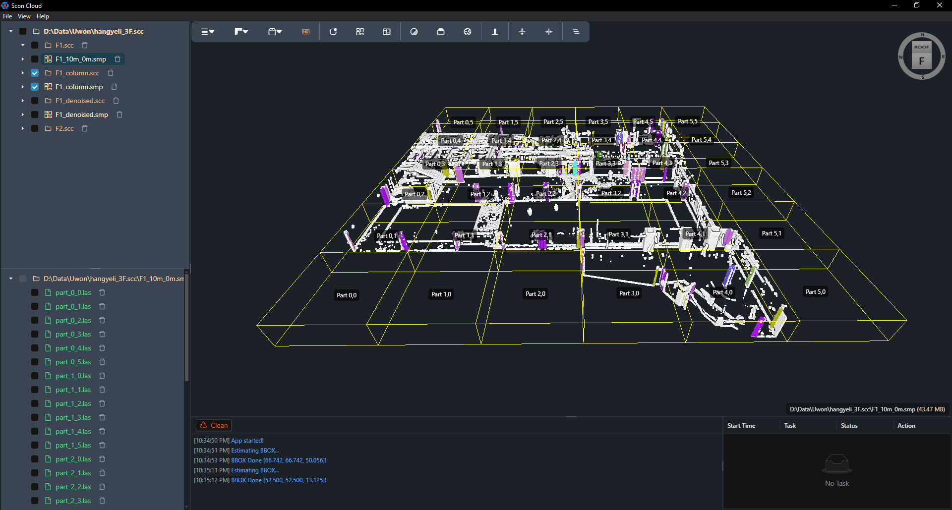
  • As-Built vs. As-Designed Comparison: Compare 3D scan/Drone data with BIM models to detect deviations early.
  • Clash & Anomaly Detection: AI pinpoints non-compliant, unsafe or out-of-tolerance construction points.
  • Spatial Progress Tracking: Update actual construction quantities over time and reduce reliance on manual reports.
Explore Construction Intelligence
03

Spatial Data & AI Systems

Build centralized spatial data infrastructure with AI to optimize business decision-making.

  • Spatial Data Integration Pipeline: Standardize and connect GIS, BIM, CAD, Satellite and IoT data in one unified data center.
  • Spatial AI Analytics Engine: Search spatial information in natural language and automatically extract business insights.
  • Custom Dashboard & WebGIS: Package analysis into intuitive Digital Twin and WebGIS tools for specialist teams.
Build a Spatial AI System

Trust through evidence

Built with real-world spatial expertise.

  • India-invested company specializing in GIS for urban planning

    (2024)
  • Planning checking cadastral maps in Vietnam

    (2020 ~ 2023)
  • R&D organization for large-scale geospatial data processing in Korea

    (2016 ~ 2023)
  • UWon Korea — structural safety diagnosis office

    (Từ 2018)
  • Dong Xanh consulting — remote sensing and GIS

    (Từ 2016)
  • 01Spatial Data & GIS
  • 02LiDAR / Point Cloud / BIM
  • 03AI & Spatial Analysis
  • 04Real-world Engineering Projects

Discuss a project

Have a spatial problem to solve?

Tell us what you're trying to understand, evaluate, or improve. We'll explore how spatial data, AI, and spatial analysis can help.

[email protected]